Dangerous winds expected to arrive earlier
Date published: 26 March 2017
Townsville residents are warned to expect dangerous winds to reach the city much earlier in the latest forecasts for Cyclone Debbie.
Advice from the Bureau of Meteorology is forecasting winds of up to 100kmh developing in the city as early as 4pm tomorrow afternoon based on Cyclone Debbie’s current path.
The Bureau’s tracking tonight was predicting Cyclone Debbie to make landfall just north of Ayr early Tuesday morning.
TLDMG and Townsville Mayor Cr Jenny Hill urged residents to make arrangements to be home and safely sheltered early.
“The TLDMG is closely monitoring Cyclone Debbie’s progress and a decision on evacuations will be taken at 5am tomorrow (Monday), which would permit enough time for people to move,” Cr Hill said.
“People need to plan their day so that they are safe with family and friends as early as possible.
“The safest place is your home. If you don’t feel safe in your own home now is the time to arrange to go to family and friends.
“Areas most at risk from storm surge are to the city’s south around Cungulla and Cape Cleveland which have been directed to evacuate.
“Based on the Cyclone’s predicted path and intensity, we are being warned to expect destructive winds of Category 3 strength or more in the greater Townsville area.
“All emergency services are primed and ready to respond.”
Key points:
- All schools in the Townsville area will be closed tomorrow
- A decision on evacuations will be taken at 5am tomorrow (Monday)
- People should be sheltered with family and friends early before winds pick up
- Calls can be directed to the Disaster Coordination Centre on 1800 738 541.
For all the latest up to date information, follow the Townsville Disaster Information Facebook page.
The Storm Tide Evacuation Guide is available on council’s website at www.townsville.qld.gov.au

Sort and Save
Next trip to the tip save time, money and the environment. Sort it, save it.

Senior’s Luncheon – Bookings Now Open
Join us on Thursday 20 or Friday 21 August for the Seniors Luncheon, a free, catered sit‑down lunch limited to seniors aged 65+, in a warm, celebratory setting.
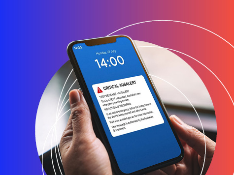
AusAlert National Test
AusAlert will be ready to use in October, but before it launches, the system needs to be tested across Australia. On Monday 27 July 2026 at 2pm, a test alert will be sent to your mobile device.

The Percivals 2026
The Percivals 2026 highlights the power of portraiture to capture emotion, identity and connection. From emerging artists to established names, this year’s exhibition offers a compelling snapshot of contemporary Australia.
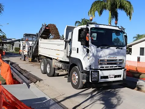
Capital Works Program
To keep Townsville growing, Council is actively involved in the delivery of projects to provide vital infrastructure and exciting development opportunities.