Ross River Dam
Looking for something else?
Ross River Dam is one of the two primary sources of water for Townsville.
Townsville City Council has a legal obligation under the Queensland State Water Supply (Safety and Reliability) Act 2008 to have an Emergency Action Plan (EAP) for both Paluma and Ross River Dams.
Documents
Frequently Asked Questions
How large is Ross River Dam?
Ross River Dam is the 9th largest dam in Queensland by storage capacity. The below fact sheet provides an overview on Ross River Dam.
How can Ross River Dam hold more than 100% capacity?
Ross River Dam is a dual purpose dam providing water for the community and attenuating floods by reducing peak inflows into the dam and releasing controlled smaller outflow into Ross River over the confined spillway.
The Full Supply Level (FSL) or 100% capacity of the dam is the level at which the reservoir is at maximum operating storage of usable water.
Any water temporarily stored in the dam above FSL is considered flood water and causes the gates to open and release the water downstream.
The level of the water above the FSL dictates the degree to which the gates opens and volume of water released try to strike a balance between dam safety on downstream flooding. The various dam operating levels and capacities are shown in the sketch below.
How much water did the dam store during the 2019 flood?
During the monsoon event from 27 January – 8 February 2019, the total volume of flood waters received in the Ross Dam catchment would have filled the dam (to Full Supply Level) nearly four times over (932,748ML).
How severe would the 2019 flood been if the dam had not been there at all?
Ross River Dam History
After significant flooding occurred in Townsville in 1890, 1927, 1946 and 1953, a detailed investigation was completed between 1965 and 1968 by the Irrigation and Water Supply Commission on the feasibility of a dual-purpose dam on the Ross River for flood attenuation and urban water supply. The report proposed development of a mass concrete spillway and earth wall dam constructed in two stages:
- Stage 1 yielding 45.5ML/day of water and storage capacity of 73,000ML
- Stage 2 yielding 113ML/day of water and storage capacity of 417,000ML.
The purpose of the staging was to defer the need to relocate the Flinders Highway and Mount Isa rail line, which is submerged by the increased storage.
1970 to 1982
Between 1970 and 1974, the design and construction of stage 1 was implemented at an approximate cost of $8 million.
In 1976, the earth wall embankment was raised to its final stage 2 height of EL 47.16m without any increase to the concrete spillway level or storage capacity.
In 1977, a 1.2m-high steel radial gate was installed to increase the storage capacity to 110,000ML.
1983 to 1990
Evaluation of the dam foundation after filling led to some remedial works being undertaken in 1983 to facilitate the final implementation of stage 2 upgrade.
By 1986, the relocation of the Flinders Highway and Mt Isa railway was complete and in 1987, the radial gate was removed and the concrete spillway raised 2.28m to EL 38.21, increasing the storage capacity to 210,000ML.
1991 to 2000
By the late 1990s, significant advances in the knowledge of hydrology (rainfall), statistically predicted larger future rainfall events. The original design had been based on traditional standards-based criteria to determine the safety of the dam, which was the approach accepted by the regulator at the time. However, a new risk-based approach was now considered to be a more effective tool in assessing dam safety by estimating the likelihood of an event occurring and its consequences.
2001 to 2003
In 2001, a risk-based assessment of the Ross River Dam was undertaken to ensure its construction was to a standard of safety that satisfied the Council, Regulator and Community.
The Ross River Dam has a large population downstream, and the assessment found a relatively high risk of failure by flood overtopping of the earth wall causing erosion of the riprap and pipe failure of the wall. This failure would have resulted in an unacceptable loss of life, as well as economic and environmental damage.
2003 to Present
By 2003, the Australian National Committee on Large Dams (ANCOLD) guidelines on risk assessment had undergone significant review. The updated guide required new dams to provide a level of risk substantially lower than the limit of tolerability of existing dams.
In 2003, the concrete spillway was cut down 3.55m to EL 34.66, reducing the storage capacity to 73,000ML, significantly reducing water supply available to the community and the risk of dam failure by flood overtopping the wall.
In 2005, an upgrade study was completed to increase the dam’s capacity to 233,000ML and maintain compliance with the new ANCOLD risk guidelines.
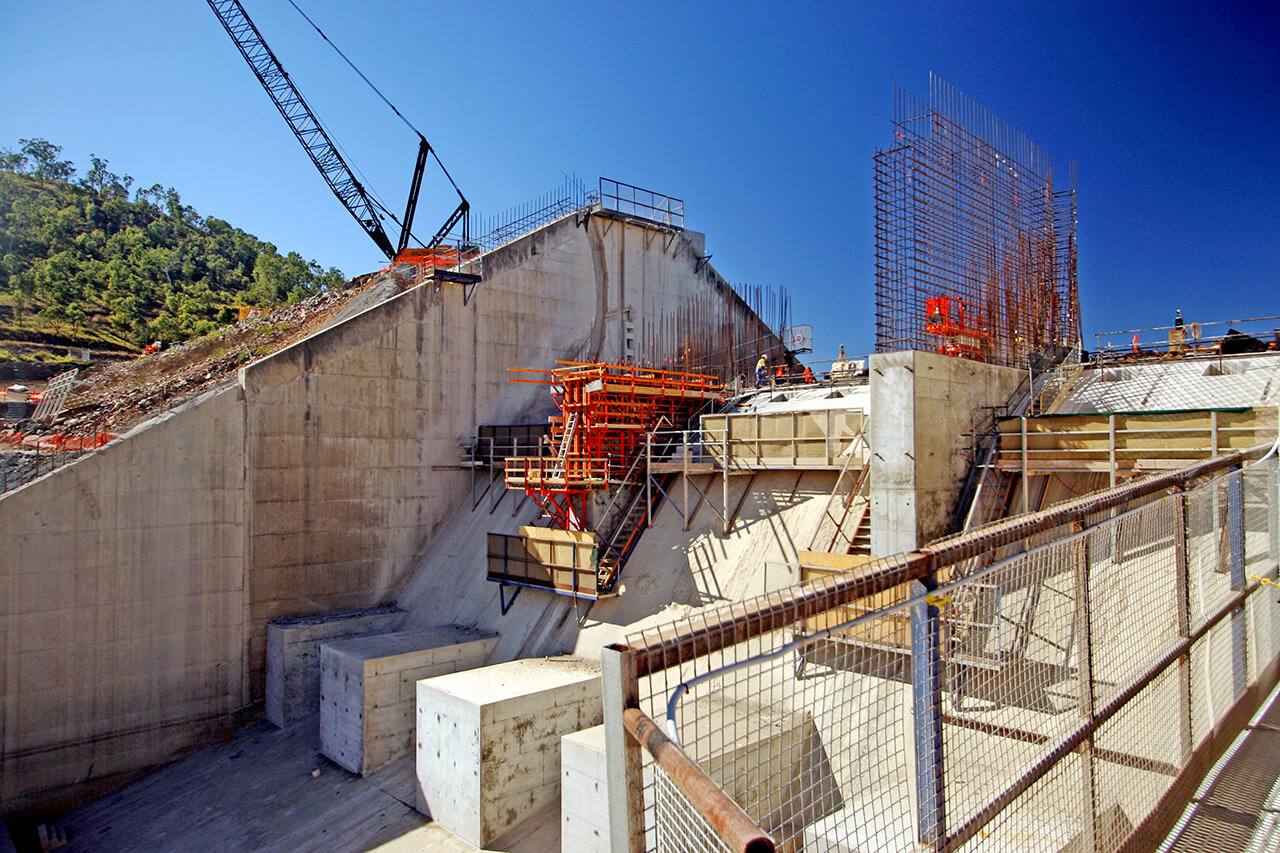
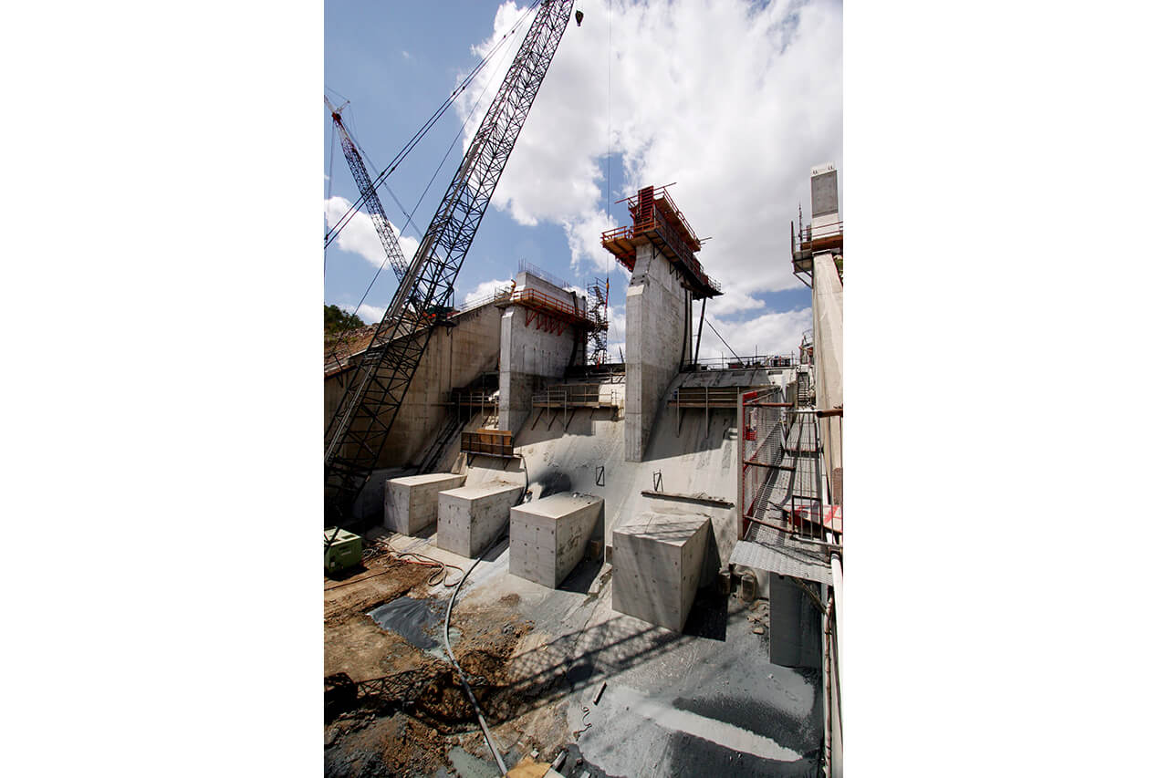
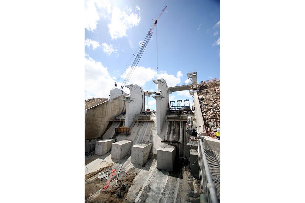
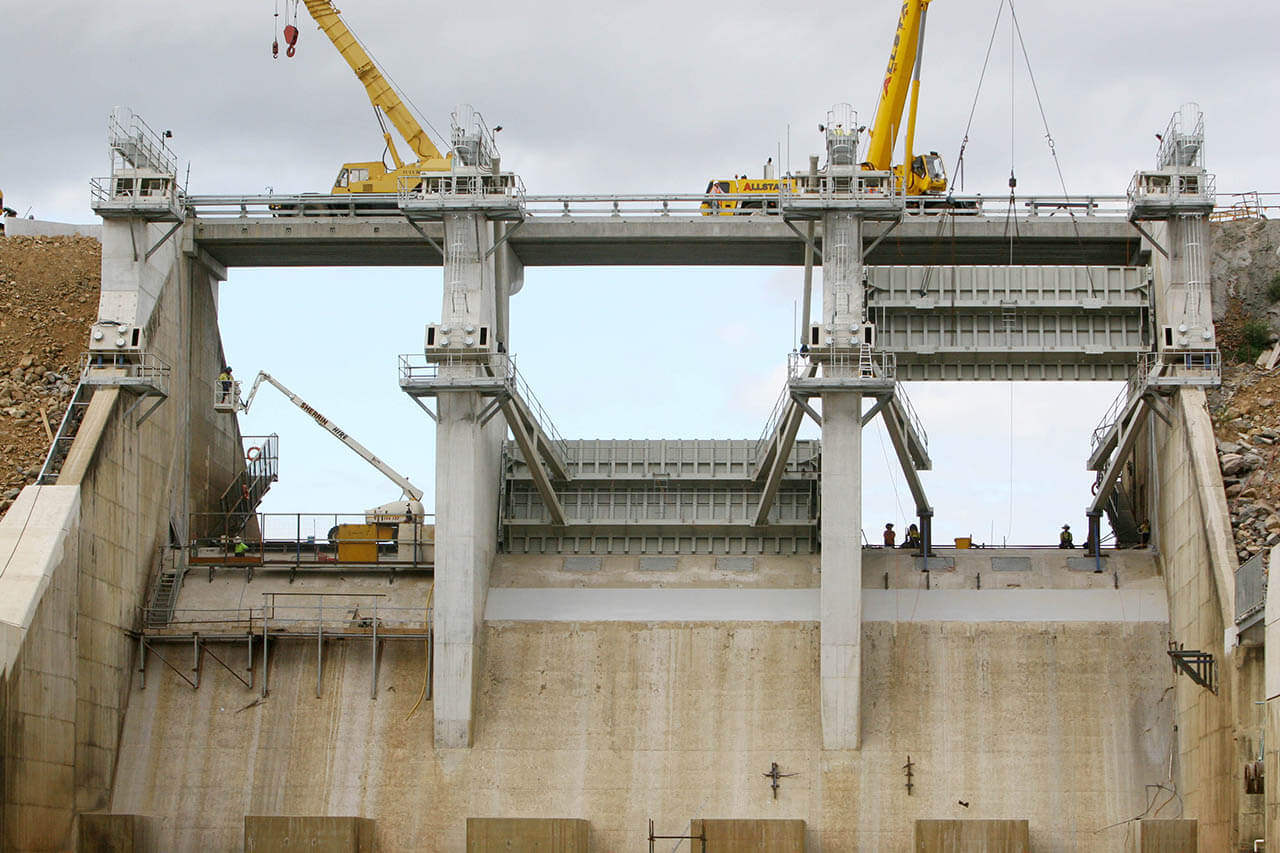
Upgrades started in 2006 and were completed by 2008 at a cost of $120 million. The works involved:
- raising the 8km-long earth embankment 0.85m to EL 48
- installing post-tensioned earth anchors to the concrete spillway
- maintaining the concrete spillway height at EL 34.66 and installing 3 radial steel gates 5.3m high to allow controlled and automated release of flood waters downstream.
Images
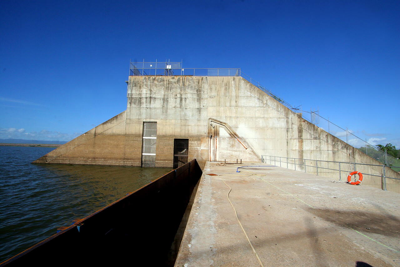
Ross River Dam - Spillway Upgrade (2006)
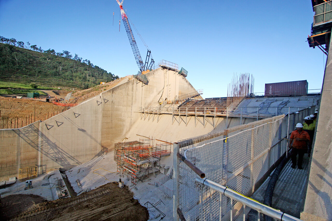
Ross River Dam - Spillway Upgrade (2007)
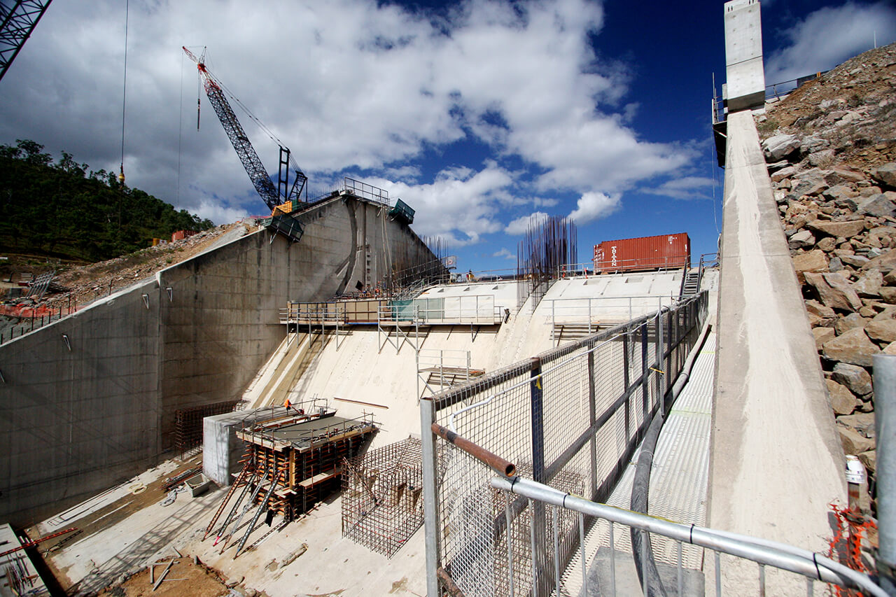
Ross River Dam - Spillway Upgrade (2007)
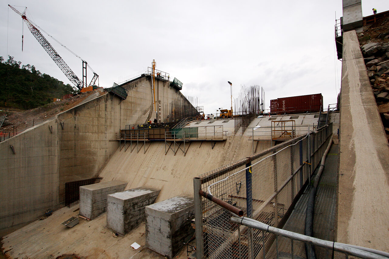
Ross River Dam - Spillway Upgrade (2007)
Ross River Dam - Spillway Upgrade (2007)
Ross River Dam - Spillway Upgrade (2007)
Ross River Dam - Spillway Upgrade (2007)
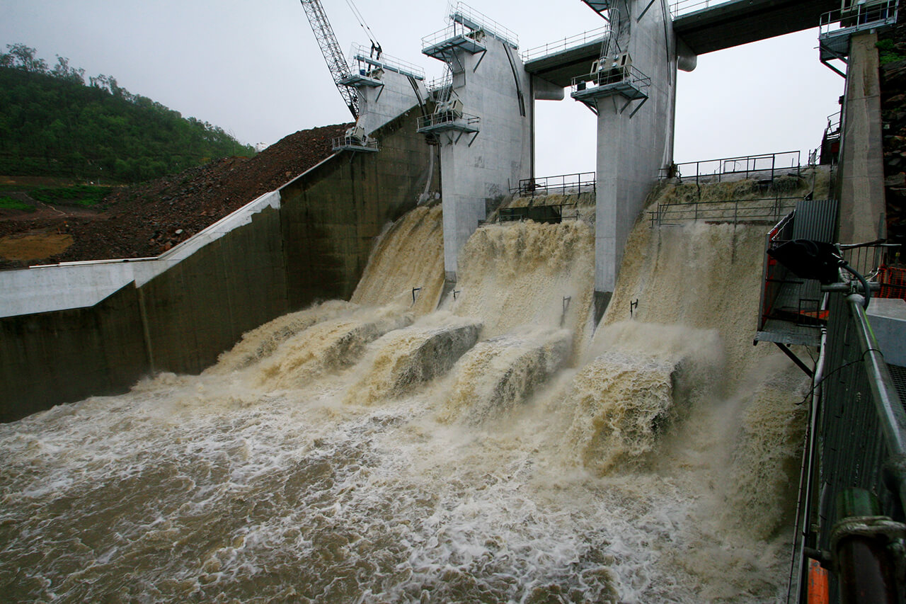
Ross River Dam - Spilling during upgrade (2007)
Ross River Dam - Installation of radial gates (2008)
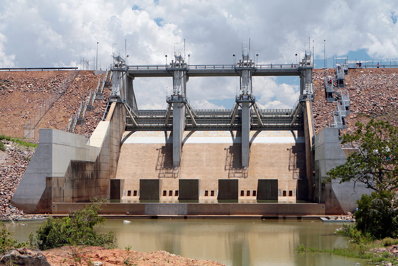
Ross River Dam - Upgrades completed (2008)

Senior’s Luncheon – Bookings Now Open
Join us on Thursday 20 or Friday 21 August for the Seniors Luncheon, a free, catered sit‑down lunch limited to seniors aged 65+, in a warm, celebratory setting.

AusAlert National Test
AusAlert will be ready to use in October, but before it launches, the system needs to be tested across Australia. On Monday 27 July 2026 at 2pm, a test alert will be sent to your mobile device.

Sort and Save
Next trip to the tip save time, money and the environment. Sort it, save it.
Capital Works Program
To keep Townsville growing, Council is actively involved in the delivery of projects to provide vital infrastructure and exciting development opportunities.

The Percivals 2026
The Percivals 2026 highlights the power of portraiture to capture emotion, identity and connection. From emerging artists to established names, this year’s exhibition offers a compelling snapshot of contemporary Australia.