Hazard Reduction Burns – May to October 2025
Council undertakes hazard reduction burns throughout the dry season each year as part of Council’s Bushfire Management Plan, to prevent the spread of bushfire and protect lives, property and infrastructure. These controlled burns reduce the build-up of flammable fuel loads such as leaf litter, grasses and shrubs.
A series of hazard reduction burns will take place across the city between May and October, as outlined below. Please note that all burns are subject to weather conditions.
| Details | Proposed Burn Date | Location |
|---|---|---|
| Roseneath – Mount Stuart Road | Postponed due to unfavourable weather conditions. | 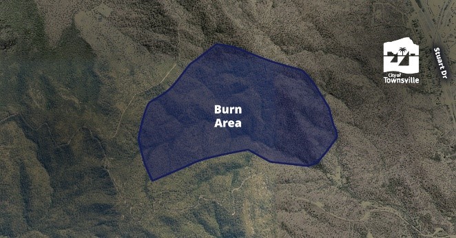 View full-sized image |
Mount Louisa – St Albans Road |
19 June 2025 (expected to take two (2) days to complete) | 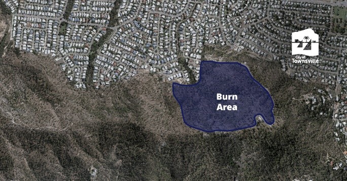 View full-sized image |
| Castle Hill – Iron Bark – Dianella Track |
24 June 2025 (expected to take two (2) days to complete) | 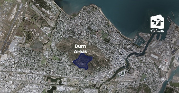 View full-sized image |
| Abbott Street Saltmarsh, Oonoonba | 25 June 2025 (expected to take one (1) day to complete) |  View full-sized image |
| Castle Hill – Water Tank |
1 July 2025 (expected to take two (2) days to complete) | 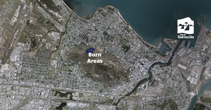 View full-sized image |
| Page Road Reserve, Black River | 29 July 2025 | 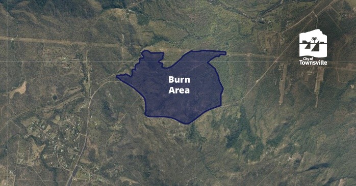 View full-sized image |
| Mount Louisa Walking Track |
31 July 2025 (expected to take two (2) days to complete) | 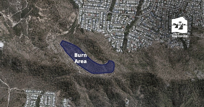 View full-sized image |
| Upper Sleeper Log Creek – Bluewater Park | 12 August 2025 | 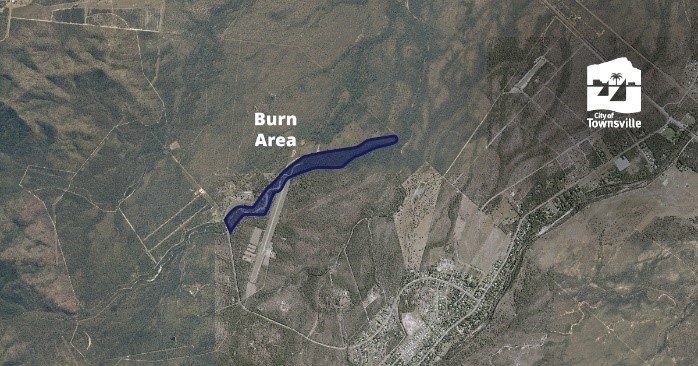 View full-sized image |
| Town Common, Mt St John | Late August / September | TBA |
| Magnetic Island Burns | DTBC | TBA |