Storm Tide Evacuation Maps
Storm Tide Evacuation Guide – Local Government Area Map
If you are not located in a coloured evacuation zone, your suburb will not be shown on the detailed maps below.

The map above provides an overview only. Detailed map information by suburb is available in the list below.
How to Read and Use the Storm Tide Evacuation Maps
- Identify your suburb from the list below. If you are not located in a coloured evacuation zone, your suburb will not be shown on the detailed maps below.
- Double click the map and use the zoom in tool for further map detail. You should now be able to identify what zone you're in.
- If you are in one of the coloured zones, you may be at risk from storm tide flooding during cyclones.
- Identify your evacuation route to your pre-determined safer location.
- During a cyclone event tune into warnings, authorities will advise which zones need to evacuate.
Storm Tide Evacuation Maps – By Suburb
Two links for each map are listed, and are identical. If you are having issues with the first map listed, try downloading from the second link for your suburb.
Balgal Beach
Belgian Gardens
Black River
Bushland Beach
Cape Cleveland – North
Cape Cleveland – South
Hermit Park
Horseshoe Bay
Mount Louisa
Mount St John
Mundingburra
Railway Estate
Rollingstone
Saunders Beach
South Townsville
Townsville City
Other Information
Last Updated: 24 January 2024

Sort and Save
Next trip to the tip save time, money and the environment. Sort it, save it.
Capital Works Program
To keep Townsville growing, Council is actively involved in the delivery of projects to provide vital infrastructure and exciting development opportunities.

The Percivals 2026
The Percivals 2026 highlights the power of portraiture to capture emotion, identity and connection. From emerging artists to established names, this year’s exhibition offers a compelling snapshot of contemporary Australia.

Senior’s Luncheon – Bookings Now Open
Join us on Thursday 20 or Friday 21 August for the Seniors Luncheon, a free, catered sit‑down lunch limited to seniors aged 65+, in a warm, celebratory setting.
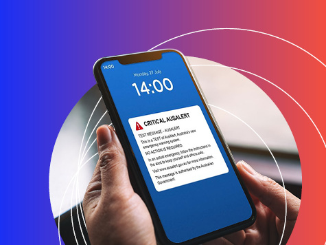
AusAlert National Test
AusAlert will be ready to use in October, but before it launches, the system needs to be tested across Australia. On Monday 27 July 2026 at 2pm, a test alert will be sent to your mobile device.