Engineering Reports
Council has a range of engineering reports and studies that are available to the public, listed below. Contact Council if you would like to obtain and plans and studies that are not linked on this page.
File size note: Some files are large and it is recommended that files be downloaded using a broadband connection to the Internet. Some files may be too large to download satisfactorily and may best be viewed in person. Some of these documents contain a large number of images and diagrams, and may be incompatible with interpretive software.
Water Demand Management
Geological Studies
- 2004 – Castle Hill Study
- 2002 – Black River Study
Storm Tide Studies
2012 – Coastal Hazard Adaption Strategy 2012 (CHAS)
This study considers the potential ongoing cumulative impacts of coastal hazards on Townsville. It outlines ways to address the coastal hazard risks for both current and projected climate changes until 2100. The strategy does not prescribe definitive measures, but will help inform future planning and development decisions in areas at high risk from coastal hazards.
Funded by the Commonwealth Department of Climate Change and Energy Efficiency, the report is one of four of its type in Australia and was undertaken by the Local Government Association of Queensland and Queensland Government as a pilot project study in partnership with the Queensland State Government Departments and Townsville City Council.
The Coastal Hazard Adaption Strategy is a high level technical background study and does not form Townsville City Council policy.
Any future adaption strategy, investigations, consultation or actions that may arise out of the report are not subject to a Queensland Government planning review and long-term funding decisions by the Australian Government.
The Townsville Coastal Hazard Adaption Strategy
- Coastal Hazard Adaption Strategy for Townsville City Council (PDF)
- Coastal Hazard Adaption Options (PDF)
- Appendix A – Vulnerability and Risk Assessment - Part 1 (PDF)
- Appendix A – Vulnerability and Risk Assessment - Part 2 (PDF)
- Appendix A – Vulnerability and Risk Assessment - Part 3 (PDF)
- Appendix A – Vulnerability and Risk Assessment - Part 4 (PDF)
- Appendix A – Vulnerability and Risk Assessment - Part 5 (PDF)
- Appendix A – Vulnerability and Risk Assessment - Part 6 (PDF)
- Appendix A – Vulnerability and Risk Assessment - Part 7 (PDF)
- Appendix B – Economic Analysis (PDF)
- Appendix C – Learnings Report (PDF)
- Appendix D – Extent of Selected Adaption Options (PDF)
2009 – Tropical Cyclone Charlotte
This report examines the impacts of Tropical Cyclone Charlotte in the Townsville Region over 12 and 13 January 2009.
2007 – Townsville and Thuringowa Storm Tide Study
2007 – Storm Tide Inundation Maps
Townsville City (Pre-amalgamation)
- Pallarenda (PDF)
- Town Common/Bohle/Mt St John (PDF)
- City/Belgian Gardens/South Townsville (PDF)
- Cranbrook/Currajong/Mt Louisa (PDF)
- Oonoonba/Hermit Park/Railway Estate (PDF)
- Stuart (PDF)
- Nome/Cungulla (PDF)
- Magnetic Island (PDF)
Thuringowa City (Pre-amalgamation)
Stormwater Management
Regional Stormwater Quality Strategy
Sustainability Reports
Flood Studies
The flood studies and flood model request can now be found on the Flood Studies page.
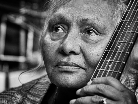
The Percivals 2026
The Percivals 2026 highlights the power of portraiture to capture emotion, identity and connection. From emerging artists to established names, this year’s exhibition offers a compelling snapshot of contemporary Australia.
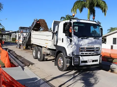
Capital Works Program
To keep Townsville growing, Council is actively involved in the delivery of projects to provide vital infrastructure and exciting development opportunities.

Sort and Save
Next trip to the tip save time, money and the environment. Sort it, save it.
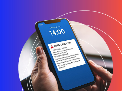
AusAlert National Test
AusAlert will be ready to use in October, but before it launches, the system needs to be tested across Australia. On Monday 27 July 2026 at 2pm, a test alert will be sent to your mobile device.

Senior’s Luncheon – Bookings Now Open
Join us on Thursday 20 or Friday 21 August for the Seniors Luncheon, a free, catered sit‑down lunch limited to seniors aged 65+, in a warm, celebratory setting.